The Hanoi-Hai Phong expressway is worth the toll, if you choose the right exit
This expressway makes the journey to Hai Phong much easier than threading your way along National Highway 5, but the toll is only part of the decision. The exit you choose can determine whether you arrive at your hotel, the airport or the correct ferry terminal without an unnecessary detour.
 23 min read
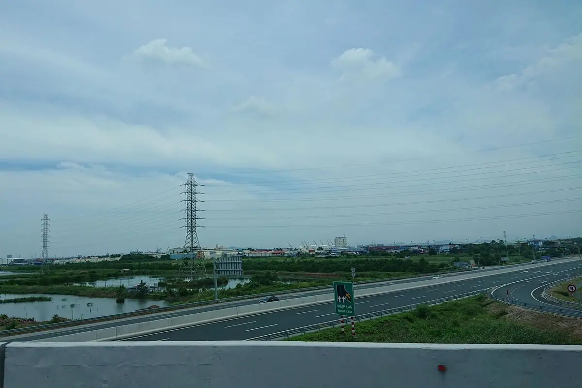
A merge-lane sign where a ramp joins the main road.
How long is the Hanoi-Hai Phong expressway?
The Hanoi-Hai Phong expressway is 105.5 km long, running from the Ring Road 3 interchange on Hanoi’s eastern side to the Dinh Vu area of Hai Phong. The expressway portion may take roughly one to one and a half hours in favorable conditions. That is not the same as the time from your Hanoi hotel to the front door of your Hai Phong hotel.
This distinction matters as soon as you start planning a day trip. A hotel in the Old Quarter may be some distance from the expressway entrance. Your destination may also be another drive away after you leave the motorway. From central Hanoi to central Hai Phong, allowing roughly two to two and a half hours for the complete drive is a more useful starting estimate, with extra time for peak traffic, poor weather or a stop.
The road has three running lanes in each direction, plus an emergency stopping lane on either side of the divided carriageway. It crosses Hanoi and Hung Yen, continues through the former Hai Duong area and reaches Hai Phong. You may see it labeled CT.04 on maps; some drivers still call it the 5B expressway.
It is built for fast intercity travel, with a maximum posted limit of up to 120 km/h on designated lanes. But a 120 km/h limit does not mean the average trip is made at that speed. Reaching the entrance, crossing the toll system and driving through Hai Phong’s urban roads all take time. So do unexpected queues at a junction.
If you need to catch a flight from Cat Bi Airport or a ferry to Cat Ba, do not use an estimated arrival time of “Hai Phong” as your planning target. Enter the airport passenger terminal, ferry terminal or your accommodation’s exact address into the navigation app. A useful plan has a destination you can actually reach, not simply the name of a city.
Where do you join the expressway from Hanoi?
The principal starting point is the Ring Road 3 interchange around Thach Ban and Long Bien, on the east side of Hanoi. Drivers approaching from Thanh Tri Bridge or Co Linh Road will see signs for the Hanoi-Hai Phong expressway. You need to follow the access ramps and overhead signs for the correct direction; the junction is not somewhere to make last-second lane changes.
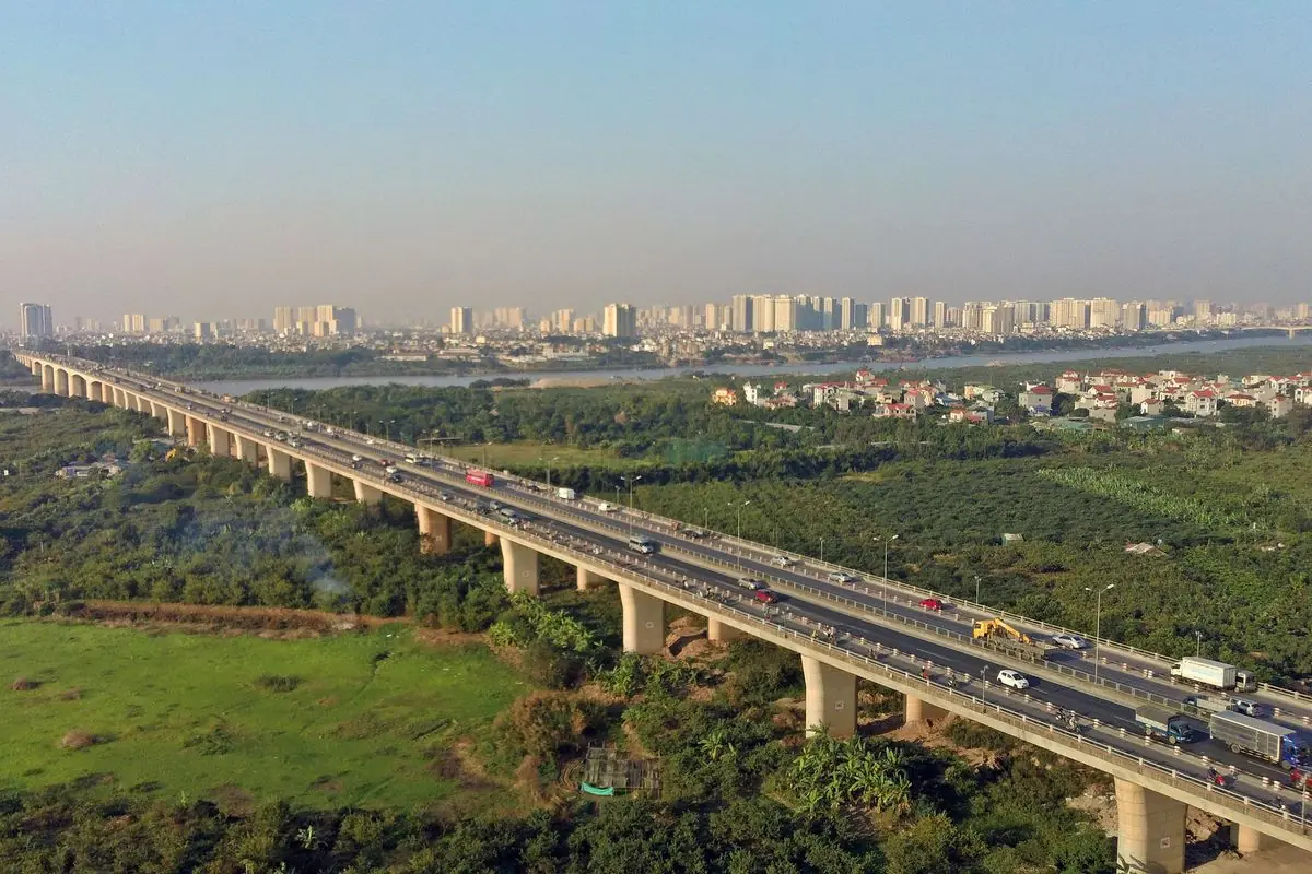
From the Old Quarter or the Hoan Kiem area, one possible approach is via Vinh Tuy Bridge and Co Linh Road. From southern or western Hanoi, Ring Road 3 and Thanh Tri Bridge may provide a more suitable connection. Which way is quickest depends on your starting address and traffic at the time. In a navigation app, select your actual final destination in Hai Phong before you leave rather than routing only to the expressway entrance.
Once on the entry ramp, build speed in the acceleration lane where provided, signal your intention, check the traffic already on the expressway and merge into the right-hand running lane when there is a safe gap. Moving directly into the middle or left lane can wait. Getting established smoothly is much more important than immediately reaching the highest permitted speed.
The full 105.5 km does not have to be driven from end to end. Starting in Hung Yen or the former Hai Duong area, you may find other interchanges closer. National Highway 39, National Highway 38, Provincial Road 392 and National Highway 38B are among the connections that can make sense for intermediate journeys. The toll depends on where you actually enter and exit.
Visitors renting a self-drive car have more important preparation to do before the motorway. Confirm that the rental contract permits the intended journey, that you hold a license legally valid for driving in Vietnam, and that the car’s electronic toll payment arrangement is clear. The vehicle may already have a toll tag, but that does not tell you who pays the bill or how the rental company will settle it afterwards.
Which exit should you take for central Hai Phong, Do Son, Cat Bi or Cat Ba?
This is the part of the route worth saving before you set out. From Hanoi toward Hai Phong, the expressway’s connections include Ring Road 3, QL39, QL38, DT392, QL38B, DT390, QL10, DT353, and the final Dinh Vu / Tan Vu connection. DT390 at Km70+600 is a newer interchange, brought into toll operation in February 2026; older route diagrams may not show it.
The names can look similar when you are approaching at motorway speed. QL means Quoc lo, or national highway. DT usually refers to a provincial road. Road numbers are especially useful if a navigation app translates place names differently from the signs in front of you.
| Where you are going | Exit to check | What happens afterwards |
|---|---|---|
| Central Hai Phong, Opera House and many downtown hotels | DT353, around Km95+500 | Follow signs toward the city center instead of Do Son |
| Do Son beach | DT353, around Km95+500 | Continue toward Do Son along the Pham Van Dong corridor |
| Cat Bi International Airport | DT353 or the Dinh Vu side, depending on the terminal approach and live traffic | Route to the passenger terminal, not merely the airport district |
| Dong Bai ferry terminal for Cat Ba | End of the expressway toward Dinh Vu | Continue via DT356 and Tan Vu-Lach Huyen Bridge toward Cat Hai |
| An Lao, QL10 or the direction of Thai Binh | QL10, around Km74 | Leave before reaching urban Hai Phong |
| DT390 and western Hai Phong connections | DT390, Km70+600 | A 2026 connection with its own electronic toll calculation |
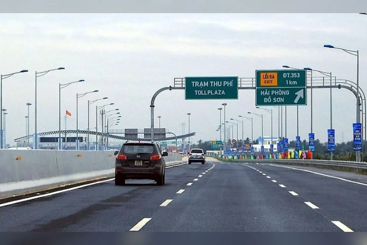
For central Hai Phong, don’t automatically stay until the end
The DT353 exit is frequently the sensible one to investigate for accommodation around the Opera House or another downtown address. From the interchange, follow the direction into central Hai Phong. The alternative branch points toward Do Son, so these two destinations should not be treated as interchangeable just because they share the same expressway exit.
There is an exception. Hai Phong stretches well beyond its central streets. A hotel in the Hai An area or a destination near Dinh Vu could make the eastern end of the route more convenient. The easiest way to decide is to compare the journey to your exact address from DT353 with the journey from Dinh Vu while you are still in Hanoi.
On a longer Vietnam itinerary, this is a useful place to separate an overnight stay from a day excursion. A hotel downtown is a good base for restaurants and city sights; it is not necessarily the shortest driving destination for a ferry, a port or a beach resort.
For Do Son beach, remember DT353 and Pham Van Dong
Do Son is not at the point where the expressway ends. Drivers generally leave around Km95+500 at DT353 and take the road toward Do Son, using the Pham Van Dong corridor. The signs at the junction distinguish the beach direction from the route into the city.
Planning to reach Do Son for an afternoon by the sea means budgeting for the extra drive beyond the interchange. Arriving at the Hai Phong boundary is not the same as arriving at the beach. This matters when you have booked a meal, need to check into a resort or hope to return to Hanoi the same evening.
On a short coastal visit, it can be tempting to stop in central Hai Phong first because it appears along the general route. Do so if the city is part of your plan, but not as an automatic detour. A direct trip to Do Son should be routed to Do Son from the beginning.
For Cat Bi Airport, navigate to the actual passenger terminal
Cat Bi International Airport lies in the Hai An area. Depending on the route and local traffic, your navigation app may suggest approaching from the DT353 side or carrying on toward Dinh Vu before turning back through the surrounding road network. There is no single expressway exit that will always be the best choice for every driver approaching the airport.
Set the destination to Cat Bi International Airport passenger terminal, and check whether the route is for departures or passenger collection. A driver dropping off a family with suitcases needs the terminal access road; an arbitrary point marked “Cat Bi” on the map will not do. Also keep enough time for the airport’s own check-in and security requirements, which are separate from the driving time.
If you have hired a private car from Hanoi, send the driver the terminal location and your flight details in advance. This is particularly useful when the booking confirmation is in English and the driver uses a Vietnamese navigation app.
For Cat Ba Island, the expressway is only the first leg
Continue toward the Dinh Vu end of the motorway and follow the onward connection through DT356 and Tan Vu-Lach Huyen Bridge to Cat Hai. From there, the Dong Bai ferry terminal serves ferries to Cai Vieng on Cat Ba Island. After the crossing, there is still a road journey to the main tourist town.
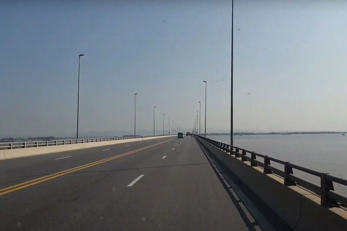
The ferry terminal is called Dong Bai, not the old Got terminal. Putting the wrong ferry location into your navigation app is an easy way to lose time after an otherwise smooth motorway drive. If you intend to take the car across, confirm current vehicle acceptance arrangements and the ferry schedule before leaving Hanoi.
Not everyone going to Cat Ba needs to take a car onto the ferry. Some travelers leave the car on the mainland and continue by passenger vessel or cable car, depending on the service they book. In that case, establish the exact terminal and parking arrangement before deciding which road to take after the expressway.
Hanoi-Hai Phong expressway tolls in 2026
The expressway uses a closed toll system, meaning the amount is based on your vehicle category and the pair of entry and exit points. A short journey between interchanges costs less than driving the whole route. There is no single toll that applies to every journey labeled “Hanoi to Hai Phong.”
The following figures are reference one-way tolls, using the 8% VAT-inclusive rates. They are useful for budgeting in 2026. The final payable amount follows the operator’s toll system and current tariff at the time of travel; tax policies and toll schedules can be updated.
Full-route toll by vehicle class
| Vehicle class | Typical vehicle | One-way toll, Ring Road 3 to Tan Vu / Dinh Vu |
|---|---|---|
| Class 1 | Cars with fewer than 12 seats, including 4-, 5- and 7-seaters; trucks under 2 tonnes | VND 215,974 |
| Class 2 | Vehicles with 12-30 seats, including many 16- and 29-seat minibuses or coaches | VND 308,459 |
| Class 3 | Passenger vehicles with 31 seats or more; relevant 4 to under 10-tonne trucks | VND 411,314 |
| Class 4 | Trucks from 10 to under 18 tonnes; 20-foot container vehicles | VND 658,186 |
| Class 5 | Trucks of 18 tonnes or more; 40-foot container vehicles | VND 848,499 |
A standard seven-seat car costs VND 215,974 one way if it uses the full route from Ring Road 3 to Tan Vu / Dinh Vu. The same Class 1 rate applies to a normal four- or five-seat car. Budget VND 431,948 for a return journey over the same full route, excluding any separate road, parking or ferry charges.
A 16-seat rental van is different. Even if it carries only six passengers and their luggage, its toll category depends on the vehicle, whatever the number of people aboard that day. This is why you should not budget every private transfer at the seven-seat rate.
The numbers are precise because the toll tables list exact dong amounts. No cash is needed for that precise amount: electronic toll charging handles the payment when your tag and linked payment method are set up correctly.
Selected Class 1 tolls for shorter journeys
| Expressway segment | One-way toll |
|---|---|
| Ring Road 3 → QL39 | VND 44,380 |
| Ring Road 3 → QL38 | VND 64,128 |
| Ring Road 3 → DT392 | VND 80,253 |
| Ring Road 3 → QL38B | VND 102,275 |
| Ring Road 3 → DT390 | VND 145,701 |
| Ring Road 3 → QL10 | VND 153,062 |
| Ring Road 3 → DT353 | VND 197,533 |
| Ring Road 3 → Tan Vu / Dinh Vu | VND 215,974 |
| QL10 → Tan Vu / Dinh Vu | VND 56,231 |
For a downtown Hai Phong journey using DT353, the Class 1 toll is VND 197,533 rather than the full-route VND 215,974. The difference is VND 18,441. That saving is useful to understand, but it should not override the more important question of which road actually brings you to your accommodation with less detouring.
The DT390 interchange deserves a separate mention because it is new enough to be absent from some older trip guides. The Class 1 toll between DT390 and Ring Road 3 is VND 145,701. Use the operating company’s online tariff lookup for any other combination of entry and exit points, rather than calculating a price by multiplying distance and a generic per-kilometer rate.
How much does a Hanoi to Hai Phong private car cost?
The expressway toll is not the price of a private car transfer. A quotation for a Hanoi to Hai Phong private car may include the car, driver and fuel, but the treatment of tolls, parking, waiting time and ferry fees varies by supplier. A one-way transfer may also have a vehicle repositioning charge built into the total.
Before paying a deposit, give the company your exact pickup address in Hanoi and drop-off address in Hai Phong. Ask for a written all-in quotation and whether the toll is included in both directions where applicable. Make it explicit when your destination is Dong Bai or a hotel on Cat Ba. “Hai Phong” is too broad to price a trip accurately.
If the driver provides a lower quote for an alternative road, ask which route they intend to take. A cheap car quotation with a much longer drive can be poor value if you have an airport transfer or a ferry connection to protect.
How does electronic toll collection work?
The expressway uses ETC, Vietnam’s electronic toll collection system. Common providers include VETC and ePass. Vehicles are identified by a toll tag and associated traffic account, with payment through an eligible linked method. You should not assume that being able to see an old account balance means everything is correctly configured under the newer traffic account framework.
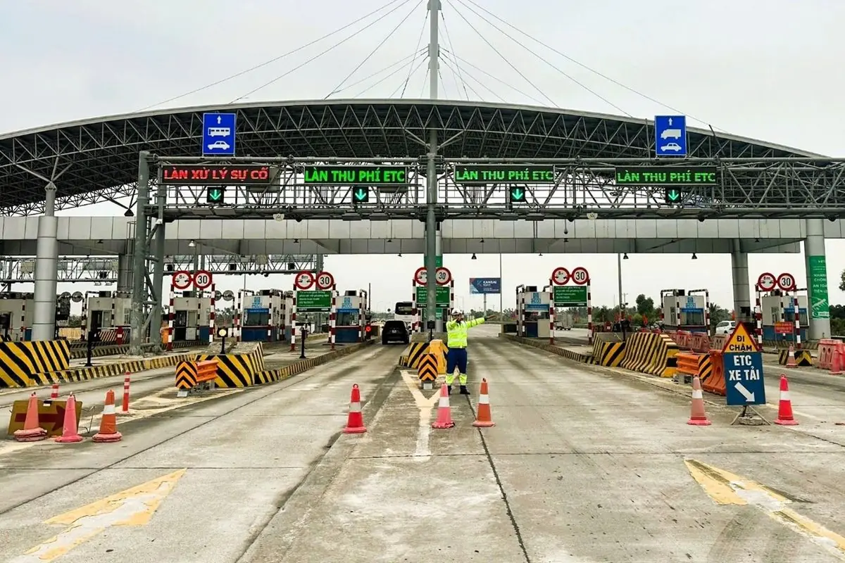
Under Vietnam’s electronic road payment rules, vehicle owners have been required to transition to identified traffic accounts connected to an eligible cashless payment method. The updated account arrangements took effect for users from 1 October 2025. Car owners should verify the tag, account identity, linked method and available funds before departure.
On a self-drive rental, ask the company whether the toll is deducted automatically and then charged to your rental bill, or whether you must fund an account in advance. Never attach another toll tag to a rental car without the owner’s instructions. Duplicate or incorrect tags only cause trouble at the entrance barrier.
On approach to the toll plaza, slow down to the posted speed, leave space ahead and follow the lane signals. Do not tailgate another vehicle to slip through an open barrier. If the toll reader fails or the barrier stays closed, follow the attendant’s instructions. Reversing or darting into another toll lane can turn a small payment issue into a serious safety hazard.
For a hired car with a driver, the operator normally handles the tag and the toll passage. Your task is to check the contract price. If the driver later asks you to pay a toll separately, refer to the agreed inclusions and ask for the relevant transaction receipt or record.
Faced with an unexpected charge, first compare the actual entry and exit points and the vehicle class. For toll or expressway operations questions, the Hanoi-Hai Phong operating hotline is 1900 6989. The ETC service provider has its own customer support channel for account and payment issues.
Where can you stop on the expressway?
There are two established service areas on the Hanoi-Hai Phong expressway: V52 at Km53+400 and PK77 at Km76+900. Each area serves both directions through separate roadside facilities. This is not the same thing as saying there are only two toll stations, or that drivers may stop anywhere along the route.
A further service area is planned around Km24+400 in Hung Yen, but the operating company’s published information describes the site as still seeking a development partner. It should not be counted on as a fully functioning stop for fuel, meals or bathrooms when planning a journey.

V52
Km53+400, an easy halfway break
V52 is the natural place to break up a drive starting in Hanoi. It has parking, kiosks, a shop, free toilets, a restaurant and a petrol station. The restaurant opens 06:00-21:00, while the fuel station runs 24 hours a day.
For a family traveling with children, it is more useful to know that toilets and parking are available than to know the exact expressway kilometer where you will be at a given time. V52 is a sensible planned stop for breakfast, a restroom break or a few minutes out of the car, rather than waiting until the need becomes urgent.
Drivers taking a private transfer can ask the chauffeur to stop at V52 in advance. This is usually simpler than requesting an unplanned stop when the vehicle is already moving at motorway speed and the next legitimate stopping point is some distance away.
PK77
Km76+900, before the final approach
PK77 is farther toward Hai Phong, approximately 23.5 km after V52 by the official kilometer markers. Facilities include an information area, a restaurant, toilets and a petrol station. Fuel service runs 24/7, although you should not assume every food counter keeps the same hours.
PK77 can be the better place to stop if you intend to keep going past central Hai Phong toward Do Son or Cat Ba. It is also a reasonable option if you passed V52 earlier without needing a break. After PK77, you are approaching the part of the journey where it becomes important to watch for your chosen exit.
Service areas are separated by direction. Heading toward Hai Phong, use the signposted access on your side of the motorway. Do not try to reach facilities across the central barrier or assume a stop shown on a map can be accessed from either carriageway.
Are there EV charging stations?
The expressway operator says there are electric-car charging facilities at service areas. There are also independent charging maps listing facilities along the Hanoi-Hai Phong route. However, listings differ on the exact service-area locations, and a charger being listed does not guarantee that its connector is suitable, the unit is working or it can be reached from your direction of travel.
Electric-car drivers need to verify the route through the official charging-network app you actually use. Check connector compatibility, charging availability and whether the station is inside a service area or requires you to leave the expressway. A charger several kilometers away on a parallel road is not the same as one directly accessible during a motorway break.
Most electric cars with sufficient real-world range can manage a journey of this length without charging in the middle if they leave Hanoi with adequate battery. But the complete drive may include the route from your accommodation, a detour through Hai Phong and onward travel to Dong Bai or Do Son. Use that full distance when deciding how much battery to start with.
Speed limits: the lane you use makes a difference
The current lane arrangement, described by the Vietnam Road Administration and in force from 19 September 2025, sets different minimum and maximum speeds for each of the three running lanes. The lane closest to the central barrier is Lane 1; Lane 3 is the rightmost running lane beside the emergency lane.
| Lane | Minimum speed | Maximum speed | Main restriction |
|---|---|---|---|
| Lane 1, beside the central divider | 90 km/h | 120 km/h | Prohibited for specified trucks, tractors with trailers, passenger vehicles over 29 seats and sleeper coaches, subject to stated exemptions |
| Lane 2, the middle lane | 80 km/h | 120 km/h | Use only when you can safely maintain the permitted speed |
| Lane 3, the rightmost running lane | 60 km/h | 100 km/h | The running lane nearest the motorway exit and emergency shoulder |
The Lane 1 restrictions are more detailed than a blanket rule covering every vehicle that looks like a truck. Certain pickup and VAN configurations, and specifically listed vehicles, are exceptions under the rules. For most visitors in a conventional four-, five- or seven-seat car, the practical issue is simpler: choose a permitted lane for your speed and drive predictably.
Do not interpret 120 km/h as a target. It is a maximum where that limit applies. If you would rather travel at a lower, lawful speed, choose a lane whose minimum permits it. For example, cruising at 80 km/h in Lane 1 would not meet that lane’s stated 90 km/h minimum under ordinary conditions.
Equally, do not stay at 110 km/h in Lane 3 simply because you see 120 km/h signs elsewhere on the motorway. Lane 3 has a lower maximum under the published arrangement. And do not treat the emergency lane as a fourth running lane when traffic is heavy.
The operator and road authorities have amended lane arrangements more than once since 2025. Always obey the signs, temporary restrictions and official traffic instructions in place on the road, especially at roadworks or in poor weather. A regulation table is a useful reference before your trip, but it does not replace the sign directly in front of you.
Safe following distance is a legal requirement
Vietnamese law sets minimum following distances at different speeds under favorable conditions: a dry, reasonably level and straight road with good visibility and no sign requiring a greater distance.
| Your driving speed | Minimum following distance |
|---|---|
| Exactly 60 km/h | 35 m |
| Above 60 to 80 km/h | 55 m |
| Above 80 to 100 km/h | 70 m |
| Above 100 to 120 km/h | 100 m |
At 110 km/h, for instance, leaving only 40 or 50 meters behind another car is not enough under the 100-meter requirement. If the road is wet, foggy, slippery or visibility is poor, drivers must allow more space than the listed distance or any applicable posted minimum. Good weather is not permission to drive close behind another vehicle.
This rule is enforceable. A driver can face penalties for failing to maintain the required following distance; staying within the speed limit alone does not make close following lawful. The exact distance can also be indicated by road signs, which must be followed when applicable.
Leaving a safe gap is especially important before changing lanes. Signaling does not give you automatic priority. Check mirrors and blind spots, signal, wait for a suitable opening and move across smoothly. As your exit approaches, prepare early rather than cutting across several lanes in one maneuver.
What if your car breaks down?
A puncture, mechanical problem or warning light can happen on an otherwise straightforward motorway trip. If the car is still controllable and it is safe to do so, move to the right-hand emergency stopping lane, switch on your hazard lights and call for assistance. The operating company’s hotline is 1900 6989.
When you call, provide the direction you are traveling, your approximate kilometer marker, your vehicle registration and a brief explanation of the problem. The kilometer signs along the expressway are particularly useful because “somewhere between Hanoi and Hai Phong” does not help a recovery team find you quickly.
Vietnam’s Road Traffic Order and Safety Law regulates stopping on expressways. If a vehicle cannot be moved into the emergency lane, the law requires hazard lights, warning equipment placed at least 150 meters behind the vehicle, and prompt notification to traffic police or the expressway operator. Your immediate priority must still be keeping passengers out of danger; do not stand exposed to high-speed traffic to arrange equipment.
The emergency lane is not a convenient place for photographs, a phone call, smoking or waiting for someone. Normal stops belong at service areas. Tired drivers should plan a rest at V52 or PK77 rather than using the shoulder to take a break.
Can motorcycles use the Hanoi-Hai Phong expressway?
No. Motorcycles, mopeds and ordinary bicycles are not permitted on Vietnamese expressways, including this one. The prohibition comes from Vietnam’s Road Traffic Order and Safety Law. A large motorcycle is still a motorcycle; engine size does not create an exception to the expressway restriction.
Riders going from Hanoi to Hai Phong must use roads that legally permit motorcycles and check the route carefully. An app optimized for cars can inadvertently send you onto an expressway if you do not specify your vehicle type. The national highway network offers possible alternatives, but you must still respect local restrictions and traffic signs.
Foreign visitors should also ensure they hold a driving license recognized for the vehicle and for use in Vietnam. Do not assume that any foreign license or an international document, on its own, is automatically sufficient. A rental company handing you the keys does not establish that you are legally licensed or properly insured to drive.
For visitors who would rather avoid driving altogether, a private car with a professional driver is often simpler than learning the local toll system, licensing rules and motorway conventions on the same day. You still get the convenience of door-to-door travel without taking responsibility for the driving.
When is National Highway 5 a better choice?
The Hanoi-Hai Phong expressway is usually the easier choice if your goal is to travel efficiently between the two cities, especially with family luggage, a private transfer, an airport journey or onward plans for Cat Ba. There are fewer interruptions than on a major traditional road, and the route is designed for longer-distance driving.
National Highway 5 (QL5) may make more sense if your starting point or destination is directly along that road, or if you need to call at businesses and industrial areas along the way. There may be little benefit in driving away from your destination to join the expressway, paying the toll and then coming back toward it.
The trade-off is that QL5 has more mixed traffic, junctions and local access points. A route that looks similar in distance on a map can take longer depending on traffic. It can also be more mentally tiring for an unfamiliar driver, because the road environment changes far more often than on the expressway.
Ask what the expected extra travel time is when a driver offers you a lower-cost journey by QL5. For a flexible day trip, the saving may be worthwhile. For a flight, ferry connection or limited sightseeing day, the faster and more direct option may be much better value.
The distance from Hanoi to Hai Phong is not one universal figure either. The expressway itself is 105.5 km, while the door-to-door driving distance changes with your starting and finishing points. Quoting the full expressway length as the distance between every pair of addresses would be misleading.
A practical plan for your first drive
Before departure, check your exact destination, the expected route and the exit you intend to use. Make sure the car is roadworthy, there is sufficient fuel or battery for the whole journey, the ETC tag is functioning and the payment method is ready. If you are taking a rental car, verify the deposit and toll settlement arrangements with the company.
Save the name of your intended interchange. For downtown Hai Phong or Do Son, that will often be DT353; for the Dong Bai ferry, you will generally be heading toward Dinh Vu before continuing across to Cat Hai. Those are different routes after the motorway. Having the exit in mind means you can start preparing for it well before the sign appears.
Families with children, or anyone who needs regular breaks, can plan a stop at V52 around the middle of the expressway. You can then decide whether to stop again at PK77. The drive is not so long that everyone necessarily needs two breaks, but knowing the legal places to stop helps.
An example planning scenario: you leave a central Hanoi hotel at 07:00, hoping to have a relaxed morning in Hai Phong. Do not promise a 08:15 arrival simply because the expressway can be covered in a little over an hour. At 07:00 you may still be crossing Hanoi and have not yet joined the motorway. A flexible morning plan is a much better fit than booking something non-refundable immediately after your optimistic navigation estimate.
For a Cat Ba trip, work backwards from the ferry schedule rather than forwards from the motorway speed limit. Allow for the drive across Cat Hai, vehicle queues and the ferry crossing, then add the journey on Cat Ba itself. If you are dropping someone at Cat Bi Airport, work backwards from the required airline check-in time instead.
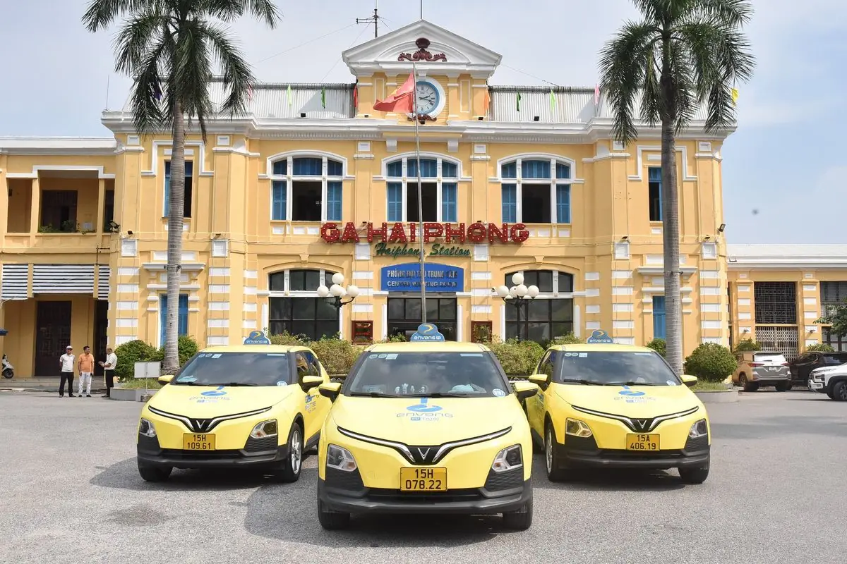
Buses, limousines and trains also connect Hanoi and Hai Phong for visitors who prefer public transport. A train can be a pleasant choice when you are staying near the station and do not need a car for the rest of the trip. A private car works better when you have several bags, multiple passengers or several stops after arriving.
Once in Hai Phong, a taxi can cover short city journeys without the responsibility of parking a rented vehicle. If you plan to spend time in Do Son or continue to Cat Ba, treat the city-to-coast or city-to-island connection as a separate part of your itinerary, with its own travel time and transport decisions.
The same approach works whether you are heading to Hai Phong for seafood, taking the family to Do Son or connecting to Cat Ba: choose the final destination first, then the motorway exit, toll and departure time. A clear route is much more useful than trying to save the last few minutes of the expressway drive.
Frequently asked questions
How long is the Hanoi-Hai Phong expressway?
It is 105.5 km from the Ring Road 3 interchange in Hanoi to the Dinh Vu end in Hai Phong. Your actual journey from a hotel or private address will usually cover a different distance.
How much is the Hanoi-Hai Phong expressway toll for a seven-seat car?
The full-route Class 1 rate is VND 215,974 one way. For a journey from Ring Road 3 to DT353, the rate is VND 197,533; to QL10, it is VND 153,062. Confirm the live charge when paying if the tariff has been updated.
How many rest stops are on the Hanoi-Hai Phong expressway?
There are two established service areas, V52 at Km53+400 and PK77 at Km76+900, with facilities on both sides for the two directions of travel. A third location at Km24+400 has been identified for development, but should not be relied on as a complete service area.
Can drivers be fined for following too closely?
Yes. The minimum legal following distance depends on speed and conditions. Under favourable conditions it is 100 metres when travelling above 100 and up to 120 km/h. In rain, fog or poor visibility, keep more distance than the standard minimum or the posted requirement.
Are EV charging stations available along the expressway?
The expressway operator says there are EV charging facilities at service areas. Before relying on one, use your charging provider's app to confirm the connector, operational status, correct carriageway and access route. Some independently maintained maps give inconsistent details, so plan a backup if you need to charge en route.